| |
Harquahala Mountain Summit -
Harquahala Mountains Wilderness
| Summary: |
The Harquahala
Mountains Wilderness is located west of Phoenix
just south of Highway 60. From 1921 to 1925, the
mountain summit was used by the Smithsonian
Institution as an observatory to study the
effects of the Sun on the Earth's climate. The
trail to the summit was constructed as a mule
path to get equipment and supplies to the
observatory staff. There is now a four wheel
drive road to the summit that approaches from
the south-west. Fortunately you won't have to
look at the road until you are almost to the
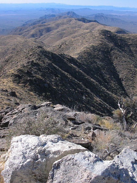
summit. The path gains a total of 3350 ft, but
since it is graded for mules, it is pitched at a
fairly comfortable angle. |
| Directions: |
From Phoenix, you
can get to the turn off to the trailhead by
either driving west on Highway 60 out of
Wickenburg or by taking I-10 west and circling
around. For the latter, take I-10 west to Exit
81 for Salome Road. Turn right off the exit ramp
and follow the road 31 miles to its end in the
small town of Salome (you may want to watch your
speed on this drive, the many cow carcasses
which line the road might hint as to why). From
Salome, turn right onto Highway 60. The dirt
road to the trailhead is located on the south
side of Highway 60 between mileposts 70 and 71.
The road is rather inconspicuous, but is marked
by a lone palm tree on the north side of the
highway. Turn south on this small & somewhat
bumpy dirt road and drive through the gate.
Immediately past the gate stay to the right,
then remain to the left at any branches as you
drive the remaining 2.1 miles to the end of the
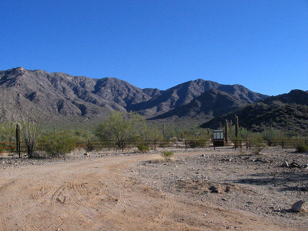
road. The trailhead features a large parking
area complete with bathroom and information
kiosk. |
| Road Conditions: |
High Clearance Vehicle |
| Navigation: |
Easy |
| Length: |
10.8 miles |
| Date Hiked: |
January 2004 |
| Weather Conditions: |
Sunny and cool |
|
Required Skills: |
None |
| Hike Description: |
From the parking
lot, walk south through the fence past the kiosk
which has trail and natural history information
(0 miles, 2320 feet). The path begins as an old,
wide road as it heads south through wide open
desert consisting of saguaro cactus, ironwood,
palo verde, creosote bush, ocotillo, & cholla. A
minute of walking will bring you to a trail
register and 10 minutes later you'll arrive at a
spot with a sign marking the location of an old
garage and corral used as a supply base for the
observatory staff. They obviously had no qualms
about throwing their garbage wherever they felt
like it, the result is the area is now
considered an historic site (though the
'history' more closely resembles trash in my
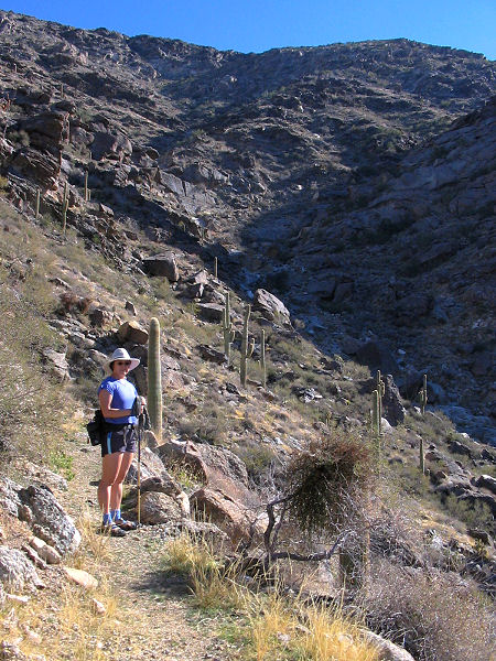
mind). Beyond this point, the road narrows and
you will now be following the old pack trail to
the summit. The path begins climbing gently
towards the foothills, then somewhat more
steeply as it travels up one of the arms of the
main mountain. The trail eventually follows a
wash filled with gray boulders a short distance
before climbing out and around to the left to
follow the same wash somewhat higher on the
slope. After crossing this wash higher on the
mountain, the path climbs out on the right and
climbs a short distance to the site of an old
mining camp. Collapsed wooden tent platforms are
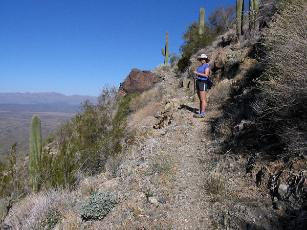
the most prominent remnant of the camp. Leaving
the site, the trail continues climbing to the
right and performs a few tight switchbacks
before topping out at a shoulder with views on
the other side of the Harquahala Mountain
Backcountry Byway (the 4-WD road that leads to
the summit). If you look to the summit you'll
also catch sight of the observatory, wind sock
and microwave tower. From the shoulder, the path
bends left and continues climbing, eventually
reaching a road, hitching post and 'Leave Horses
Here' sign. Turn right and follow the road the
short distance remaining to the summit (which
you might be sharing with those that drove up on
the road). The summit features a picnic table,
the old fenced off observatory building, and a
microwave tower. There are also interpretive
signs which explain the history of the old
observatory as well as the current use of the
mountain by the Central Arizona Project to
direct water use in the CAP canals. When ready,
return the way you came. |
| Rating (1-5 stars): |

The author and his wife completed this hike at a
medium pace in 5.5 hours. |
| Maps: |
None |
| Books: |
Exploring Arizona Wild
Areas - Scott
S. Warren |
| Photos: |
Click picture for larger view, click your browser's 'Back' button to return to this page. |
|
|