| |
Castle Dome Peak - Kofa National Wildlife Refuge
| Summary: |
A steep climb to
the summit of Castle Dome Peak in the southern
portion of the Kofa National Wildlife Refuge.. |
| Directions: |
From Quartzite, head south on US
95 for about 48 miles, or from Yuma head north
on US 95 for about 35 miles to mile marker 55.
Turn east onto Castle Dome Mine road (heading
towards the Castle Dome Mine Museum). After 2
miles the pavement ends and the road becomes
well graded dirt for the next 8 miles to the
Castle Dome Mine Museum. Stay straight at the
museum on the road which becomes rather rougher.
Drive 4.6 miles past the museum to a prominent
pull off on the right (east) which has a "No
Vehicles Beyond This Point" sign posted.
Update: Castle Dome Mine Road is closed at the
museum. Supposedly a rough bypass exists that
heads north from Castle Dome Mine Road at 761293
mE, 3658073 mN (though I haven't driven this
route). |
| Road Conditions: |
High Clearance
Vehicle |
| Navigation: |
Moderate |
| Length: |
5 miles |
| Date Hiked: |
February 2008 |
| Weather Conditions: |
Sunny and Nice |
|
Required Skills: |

 |
| Hike Description: |
From the parking
area hike east and slightly north until you
reach a wide sandy wash. Follow the wash east to
a series of cairns at the GPS coordinate below.
Leave the wash to the right and head up the
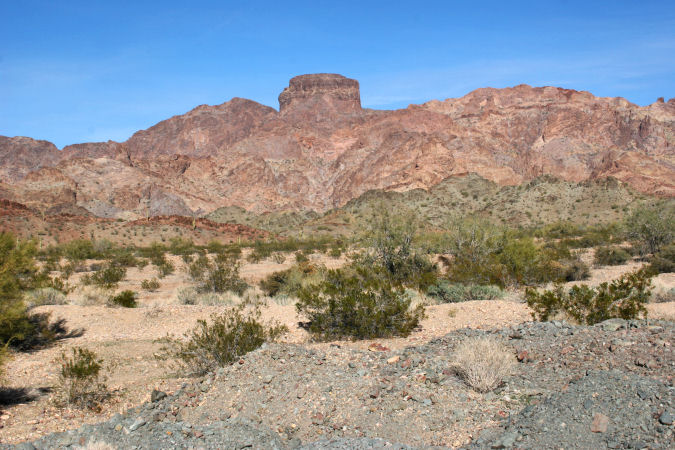
slope to the southeast. Looking up, Castle
Dome Peak looms above. Just to the left of the
peak is an obvious rock spire. Follow a faint
trail which is marked with cairns at fairly
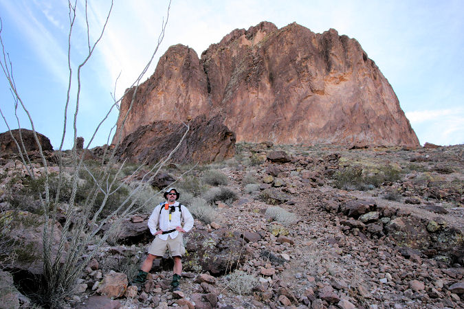
frequent intervals up to the base of the peak.
The route becomes progressively more steep and
the scree underfoot increasingly loose as you
climb. At the base of the mountain the path
contours left to a small saddle between the
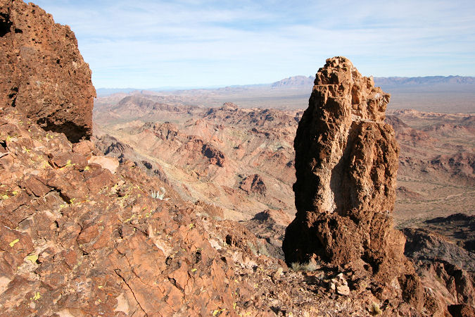
spire and the peak. From this point there are
two ways up. The most obvious is a rather
verticle crack climb which goes up and over a
small chockstone. The pitch is about 20 feet
high and has easy hand and footholds. Those
unnerved by heights should backtrack down the
slope 10 yards and identify a steep ramp you had
passed earlier which is now on your left (not
obvious). Both routes lead to the same place,
though the second is considerably less
intimidating. Once above this crux, the
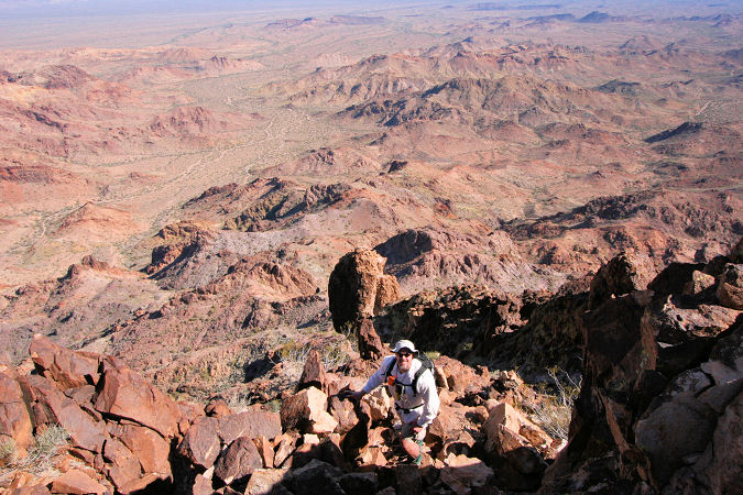
remainder of the hike involves a steep scramble
up the rock slope to soon gain the peak which
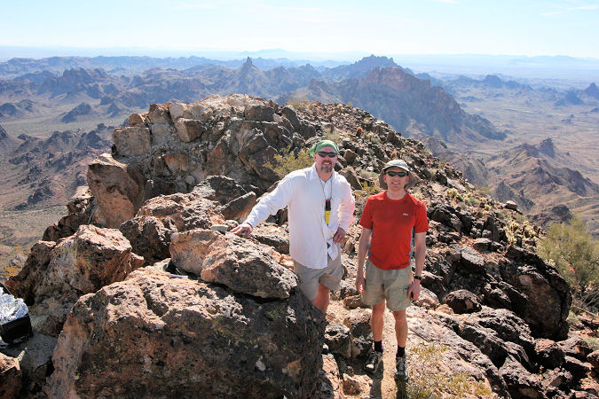
features tremendous 360 degree views of the
Castle Dome Range to the east, the Kofas to the
north and a desert expanse to the south and
west. There's a register in an ammo can for you
to log in. When ready, return the way you came.
Be sure to watch your footing, the way down is
considerably more treacherous than the ascent.
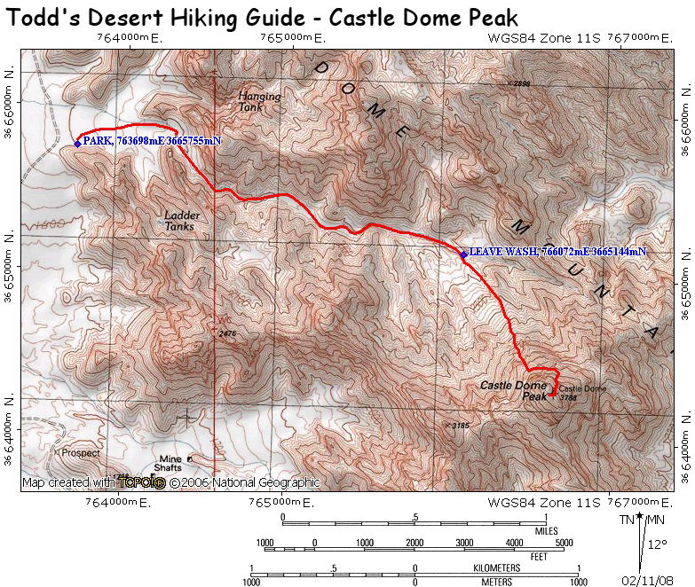
Castle Dome Peak GPS
Coordinates
(UTM):
Park: 763698 mE, 3665755 mN
Leave Wash: 766072 mE, 3665144 mN |
| Rating (1-5 stars): |

The author and a friend hiked to the top and
back in 5.5 hours. |
| Maps: |
Click here
for a map of the area. |
| Photos: |
Click picture for larger view, click your browser's 'Back' button to return to this page. |
|
|

