| Home | Warning | Gear | Books | Photography | Hikes | Links | Flora & Fauna | Etiquette | About Me | What's New |


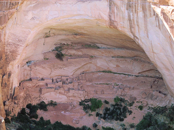
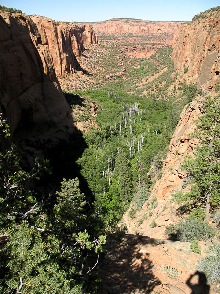
Sandal and Aspen Forest Overlook Trails - Navajo National Monument, AZ

Summary: Two short interpretive trails with some good views and natural history.
Directions: Navajo National Monument is located east of Page or west of Kayenta on Highway 160. Between mile post 374 & 375 on Highway 160, turn north at the sign for the Monument on Route 564 and drive 9 miles to the Visitors Center. Surprisingly enough, there is no fee to enter, camp or hike in the Monument.
Road Conditions: Passenger Car - paved all the way
Navigation: Easy
Length: 1.8 miles
Date Hiked: May, 2006
Weather Conditions: Warm
Required Skills: None
Hike Description: Both trails begin behind the visitor center.
Sandal Trail: Is a 1 mile (roundtrip) interpretive trail which winds it's way along a paved path to a cliff which overlooks the Betatakin Ruins.

Aspen Forest Overlook Trail: This 0.8 mile (roundtrip) interpretive trail splits off to the left about 100 yards down the Sandal Trail and leads down a series of steps to the head of Betatakin Canyon.
Both trails offer signs which identify local plants in the area and some of ways Native Americans put them to use in their daily lives.
Rating (1-5 stars):
There is not much to these trails, but they offer some good information and nice views.
Maps: None
Books: None used
Photos: Click picture for larger view, click your browser's 'Back' button to return to this page.
Betatkin ruins from the Sandal Trial. Betatakin Canyon.