| |
Trail #114 to Mingus Mountain -
Prescott National Forest
| Summary: |
A steep hike to a forested
mountain with views to the south into Black
Canyon and north to Sedona and beyond. |
| Directions: |
From Phoenix take
I-17 north to Camp Verde to exit 287. Turn left
(west) onto Highway 260. Between mileposts 209
210 turn left (south) onto the dirt Ogdon Ranch
Road (ok for passenger cars). Follow this road
4.3 miles to the parking lot at the end (watch
where you park, there is broken glass
everywhere). |
| Road Conditions: |
Passenger Car |
| Navigation: |
Easy |
| Length: |
14 miles |
| Date Hiked: |
January 2006 |
| Weather Conditions: |
Sunny |
|
Required Skills: |
 |
| Hike Description: |
From the parking lot (4100
ft, 0 miles), pick up
the wide ATV track as it heads west. After about
50 yards, turn left onto a side trail, which
drops down and crosses a brushy dry wash. The
trail climbs up the other side, then climbs
moderately as it skirts several minor drainages.
The well defined path soon begins climbing
steeply, eventually becoming a foot path before
it levels out on the hillside to the north of
Black Canyon. The trail climbs at a considerably
more gentle grade as it winds along the hillside
with views down into the canyon. After some
walking a minor use trail splits to the left,
continue to ascend on the main path. Eventually,
the path veers to the right to circumnavigate
the head of a large side drainage and begins
climbing steeply once again. The path continues
its steep ascent around a few upper tributaries,
eventually climbing up to a manzanita covered
shoulder. The trail now descends steeply,
passing an old trail sign reading Allan Spring
Rd 1 ¾ miles to travel beside the stream of
Black Canyon (flowing when I was here). The path
ascends gently to moderately through the pines
before turning away from the spring to
eventually end at Allan Spring Road, a rough
dirt track (6400 ft, 7 miles). There is a trail sign (the only one
visible on the hike) located on the side of the
road indicating that you have been traveling on
Trail #114. When ready, return the way you came
(14 miles). |
| Rating (1-5 stars): |
 
The original purpose of this hike was to
utilize Trail #114 as our entry route for a
canyoneering descent of Black Canyon. However,
the temperatures were much cooler than expected
and the rocks on Mingus Mountain were coated with
ice. Rather than risk hypothermia, we opted for
the hike as an alternative. The author and a
friend completed this hike at a quick pace in 6
hours. |
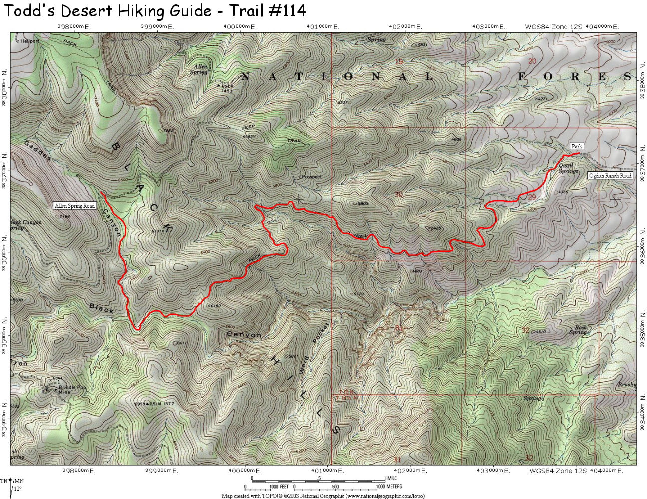
| Maps: |
Click here for a map of the
hike. |
| Books: |
Portions of this hike is contained in:
Canyoneering Arizona (2nd edition)
- Tyler Williams |
| Photos: |
Click picture for larger view, click your browser's 'Back' button to return to this page. |
 |
 |
Starting up the ATV track that
is the start of the trail. |
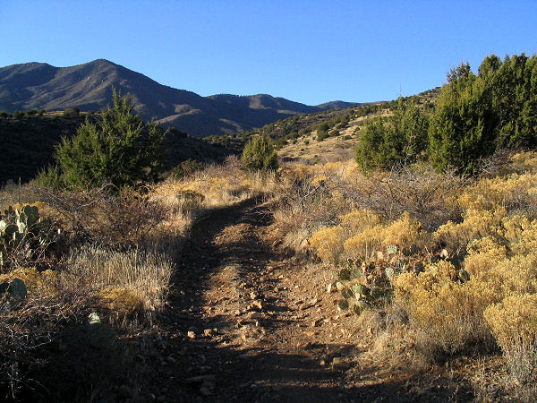
Trail
#114 as it winds its way
above Black Canyon. |
 |
|
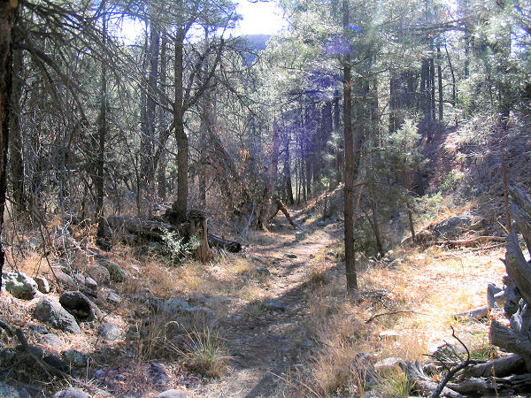
| The
upper pine forest. |
|
|
|
