| |
Sterling Pass to Vultee Arch - Sedona
| Summary: |
An out and back hike via a lesser used
route to a natural arch in Sedona. |
| Directions: |
From the junction of Highways 179 and 89A
in Sedona, head north on 89A for 6.5 miles to just past mile marker 381 and
the Manzanita Campground. There are a few small pull offs suitable for 2-3
small cars on the west side of the road. If these are taken, save the hike
for another day since there is no shoulder on 89A to walk along and lots of
traffic. |
| Road
Conditions: |
Passenger Car |
| Navigation: |
Easy |
| Length: |
5 miles |
| Date
Hiked: |
May 2005 |
| Weather
Conditions: |
Warm & sunny |
|
Required Skills: |
None |
| Hike
Description: |
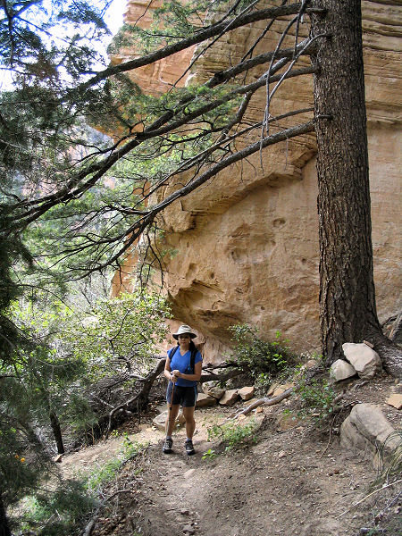
From 89A, locate the rusty metal Sterling
Pass #46 sign which marks the start of the trail. The well maintained trail
climbs moderately to steeply up through a nicely forested area of pine,
juniper and oak. As you continue up the canyon the path becomes steeper and
climbs about 1000' in a little over a mile to Sterling Pass. There are
several use paths at the pass, stay straight on the trail that immediately
begins descending down the other side. The path descends moderately to
steeply through more forest, eventually leveling out somewhat to travel
beside a small stream, which was flowing when I was here. Soon you'll reach
a trail junction and sign pointing back to the right for Vultee Arch (2.4
miles), the Sterling Trail continues straight another 1.6 miles to the Dry
Creek Trailhead (the more popular and easy route to this point). Turn right
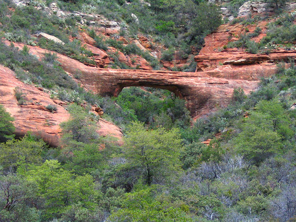
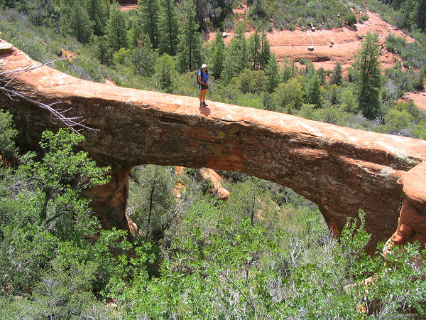
and in a few minutes you'll spot the arch on the hillside to the left. The
arch is sort of blocky as arches go, but nice enough. There is a brushy use
trail that travels through the manzanita and scrub oak right up to the arch
if you want a better view. When ready, return the way you came (5 miles). |
| Rating
(1-5 stars): |

The author and his wife completed the hike to the arch and back at a
moderate pace in 3 hours. |
| Maps: |
Bear Tooth Maps: Sedona |
| Books: |
'The Favorite Hikes: Flagstaff & Sedona'
by Cosmic Ray |
| Photos: |
Click picture for larger
view, click your browser's 'Back' button to return to this page. |
|
|