| |
Elephant Head / Chino Canyon,
Santa Rita Mountains
| Summary: |
Elephant Head is a moderately sized rocky peak in the
northwestern part of the Santa Rita Mountains. This report describes a route
to the summit and optional descent of Chino Canyon. Note: Chino canyon is a
rugged off trail hike which involves climbing and possibly rappelling. This
route should only be attempted by experienced hikers. I'd also recommend
carrying 120 feet of rope and descending gear. |
| Directions: |
From Tucson drive south on I-10 to I-19. Take I-19 south
to Exit #56 for Canoa Road (zero your odometer here). Turn left at the
bottom of the exit ramp and drive under the highway. At the stop sign turn
right onto the Frontage Road which parallels the highway south. After 3.2
miles turn left onto Elephant Head Road and follow it for 4.2 miles (passing
roads on the right named for birds) and turn right onto Hawk Road. Follow
Hawk to its end 2.2 miles later and go straight over the cattle guard on a
somewhat rougher dirt road. Follow the dirt road for 1.7 miles to a gate on
the left (there is no 'no trespassing sign' on this one). Go through the
gate and follow this rougher dirt road towards the prominent peak of
Elephants Head. After 0.4 miles turn right onto Forest Road 4073 which drops
down and crosses a dry wash and passes through another gate. After 1.2 miles
you'll reach a sign for Madera and Chino Canyons, stay straight heading
towards Chino. Pick a place to park under the looming face of the Elephant
(there is no defined parking here, just pick a place to pull over). Be aware
that the road only gets worse the further you go. |
| Road Conditions: |
High Clearance Vehicle - if you take it slow |
| Navigation: |
Moderate - one tricky intersection |
| Length: |
~8 miles |
| Date Hiked: |
February, 2003 |
| Weather Conditions: |
Sunny & windy |
|
Required Skills: |

 |
| Hike Description: |
From wherever you decided to park, continue following the
road south through Chino Canyon. After a bit of hiking, the road bends to
the southeast and begins climbing more moderately to a metal sign indicating
the location of an old mill. The road continues climbing to a point below a
radio tower located high on the hill above you, shortly thereafter, it turns
north and becomes more trail-like in the process. The path climbs moderately
as it travels around an unnamed peak. As you come around the other side of
the hill, you'll have views across the Chino Canyon drainage to the Elephant
Head on the other side. As the path begins to bend more easterly, keep your
eyes open for a somewhat less traveled use trail on the left marked by a
stick and small cairn. Follow this trail down to the left (watch your
footing on the loose gravel) into Chino Canyon, then up the other side to
the Elephant Head ridgeline. The path then bends left and traverses the
ridge to the base of the peak where you'll find the route to the summit
marked by cairns at frequent intervals. The climb to the summit is steep in
places, but does not have any significant exposure. At the top you'll find a
little shrine to the elephant and great views into the valley below and into
the higher reaches of the Santa Rita Range to the south and east. When
ready, return the way you came. Experienced and well prepared hikers with
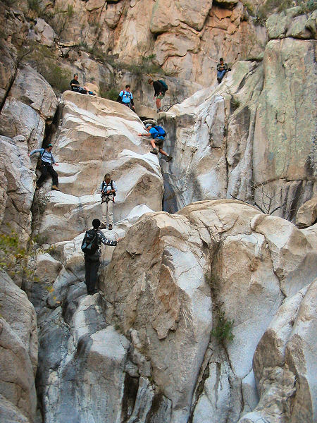
good climbing skills may wish to descend Chino Canyon for the return route.
To do this, retrace your steps from the Elephant Head summit to the point
where the path crosses the Chino drainage. Leave the trail and head down
canyon. Chino Canyon features some nice scenery as well as several pools and
down climbs (on polished stone) that must be negotiated. There are usually
multiple ways down each drop off and routes around the pools. Take your time
at each drop to scout out the easiest route. Be sure to carry a rope and
harness through this section just in case you get stuck. After an hour or so
of climbing, the canyon becomes wider and flatter until you reach the road
you hiked in on earlier. Follow the road back to your vehicle. |
| Rating (1-5 stars): |

The author has completed this hike as a group of 10 in about 6 hours. About
half the group performed a 40 foot rappel in the descent of Chino, the other
half down climbed the entire canyon. |
| Maps: |
A map of the route can be found
here. |
| Books: |
None |
| Photos: |
Click picture for larger
view, click your browser's 'Back' button to return to this page. |
 |
 |
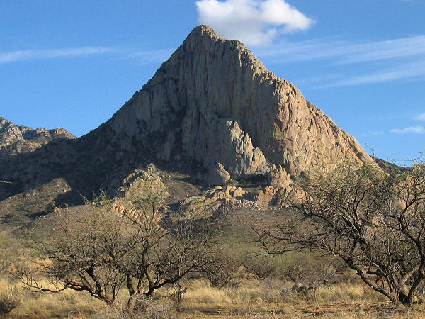
| The goal of the hike. |
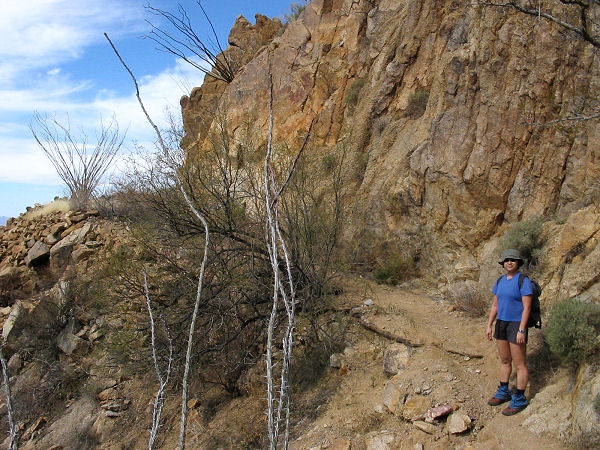
Climbing. |
 |
 |
 |
|
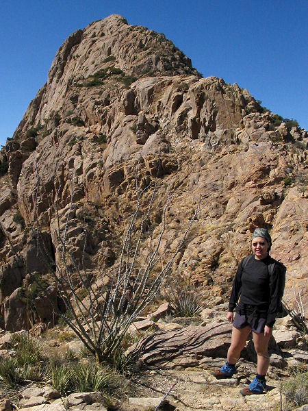
Just below the
summit. |
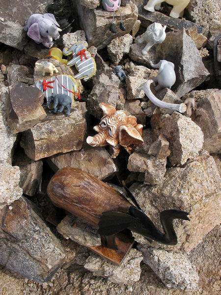
Elephant shrine. |
Chino Canyon
descent. |
|
|
