| |
East Divide Loop, Galiuro
Mountain Wilderness
| Summary: |
A two day backpacking trip in the Galiuro Wilderness
located south of Safford. Finding water may be difficult in this area.
Unless it has rained recently you may want to carry all the water you will
need. |
| Directions: |
From Phoenix take Highway 60 east to
Globe, then follow Highway 70 east towards Safford. After passing through
the one horse town of Fort Thomas, turn south at the sign for Aravaipa /
Klondyke Road. Drive approximately 25 miles on this well graded dirt road
and turn left at a fork in the road, following the sign for Bonita /
Klondyke. Drive 4.4 miles and turn right at the sign for Deer Creek onto
Forest Road (FR) 253. The road becomes rougher at this point and will
require a high clearance vehicle. Drive 7.1 miles on FR 253 until you reach
the road to the old trailhead marked by a Coronado National Forest Sign
(which now has a locked gate across it). Stay left on FR 253A and drive a
short distance down the hill. Immediately after crossing a dry wash look for
the large parking area and trailhead on the right. |
| Road Conditions: |
High Clearance Vehicle |
| Navigation: |
Moderate |
| Length: |
Day 1: 10 miles or 11 miles with optional detour to
Kennedy Peak
Day 2: 8 miles
Signs along the way provide differing mileages, the above are approximate. |
| Date Hiked: |
November 2005 |
| Weather Conditions: |
Sunny & cool |
|
Required Skills: |
 |
| Hike Description: |
Day 1: From the trailhead, begin walking on the
rocky, well defined path as it winds through the juniper dotted grassland,
climbing gently towards the mountain range ahead. After 0.8 miles you will
reach a signed junction with the East Divide Trail #287 which heads left and
the Horse Canyon Trail #254 which heads right. Go left on the East Divide
Trail which is a bit faint at first but is marked at fairly frequent
intervals with cairns. The path climbs gently to moderately and soon becomes
easier to follow as pinyon pine becomes more prevalent. The trail eventually
drops into a wash (dry when I was here) and a junction with a right
branching trail that heads 0.5 miles to Mud Spring. Stay straight (don't
cross the wash) and continue climbing up beside the wash through a forested
canyon of oak. The path soon begins climbing in earnest and after a bit of
effort tops out at a shoulder and junction with the Corral Canyon Trail #291
which heads straight, while the East Divide Trail heads left. We will go
straight on the Corral Canyon Trail, but first, there is a short side trip
to Kennedy Peak (the second highest point in the Galiuro Wilderness at 7549
ft, Basset Peak to the south is slightly higher), that is worth the effort
to complete (about 1 mile round trip). To reach Kennedy Peak, drop your pack
and head left along the East Divide Trail for 5 minutes until you reach a
fallen trail sign and fence line. Look to the left on the near side of the
fence for a cairned trail which leads to the top of the peak which features
270 degree views of the Sulfur Springs grasslands and the Pinaleno Mountains
to the east, the Santa Teresa Wilderness to the northeast and the inner
Galiuro Wilderness to the west. When ready, return to the trail junction and
head east on the Corral Canyon Trail which soon begins a steep and rocky
descent along a series of hillsides. The route is a little faint and
overgrown in this section, so keep your eyes peeled. In time, the path
performs a series of switchbacks and crosses a wash, descends some more
beside the drainage, then climbs out on the right. It then continues its
steep descent, eventually dropping down (watch for cats claw lurking in the
dry grasses) into the wash once more at Corral Spring (dry when I was here).
The path continues to descend alongside the wash on one side or the other,
becoming less steep until it eventually reaches Rattlesnake Creek (also
dry). Stay right and follow the flat, easy trail down canyon through a pine
forest, passing a number of nice campsites along the way. The trail
eventually arrives at Powers Garden, a group of grubby buildings and corral
for the pack mule set. This is not a particularly nice place to camp, I
suggest heading up or down canyon a ways to set up camp for the evening (up
canyon if you're getting your water from Rattlesnake Creek).
Day 2: Just beyond the Powers Garden corral, turn right on the
Tortilla Trail #254 as it heads across Rattlesnake Creek and begins winding
its way up Horse Canyon. There is a somewhat confusing spot where the path
is blocked by a fallen tree. Stay to the right after crossing the tree and
the path will begin climbing up Horse Canyon on the right hand side of the
drainage (facing up canyon). The trail is extremely well trodden, so if the
path you are on looks faint, you are not on the trail. The track climbs
moderately to steeply along hillsides next to a series of washes, eventually
exiting Horse Canyon to climb up into the grasslands to a shoulder. It then
winds along the hillside for a while, before climbing once again, making a
broad curve around a large drainage. The path then drops gently down to a
wash and two large metal water tanks, only to begin ascending once again
next to the streambed. The path never ventures far from the wash, so ignore
any use trails that veer off to one side or the other. In time, the route
climbs out on the left to a junction with Trail #278 which heads left
towards the Sycamore Trail. Stay to the right on the Tortilla Trail which
makes a steep ascent along a series of switchbacks to a shoulder next to an
escarpment. It then winds its way around this rocky outcrop to begin a long,
rocky descent into the grasslands below to Mud Spring (a cow trough) and a
junction with the left branching Sycamore Trail. Stay to the right following
the sign for Deer Creek Cabin. A half mile later the path passes the old
East Divide Trail which branches right. Stay straight (left) and follow the
path through the grassy hills for 1 mile to the Deer Creek Cabin and road.
Follow the road out to the gate and FR 253. Turn right on FR 253A and follow
this road the remaining half mile back to the trailhead and your vehicle. |
| Rating (1-5 stars): |

The author and his wife completed the hike to Powers Garden at a casual pace
in 7.5 hours. The next day we hiked out on the Tortilla Trail in 5.5 hours.
All washes and springs were dry when we were here, with the exception of Mud
Spring (which was surrounded by cows). We also saw some water in Horse
Canyon near the Rattlesnake Creek junction on the hike out. |
| Maps: |
Coronado National Forest - Safford and Santa Catalina
Ranger Districts |
| Books: |
None used |
| Photos: |
Click picture for larger
view, click your browser's 'Back' button to return to this page. |
 |
 |
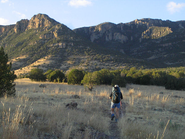
| Hiking towards the mountains. |
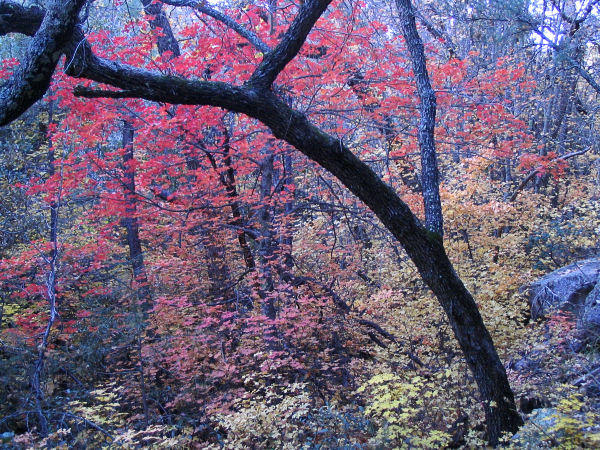
Autumn colors. |
 |
 |
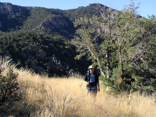
| View from Kennedy Peak. |
Rattlesnake Creek. |
 |
 |
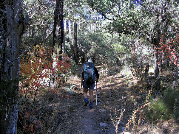
| Exiting Horse Canyon. |
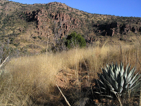
Agave and escarpment. |
|
|
