| |
Deer Creek Loop - Tonto National Forest
| Summary: |
Nice stream
side loop hike in the Mazatzals.
Note: This
hike was completed prior to the Willow fire
which burned through the Mazatzal Wilderness in
June and July of 2004. Actual trail conditions
may differ from those described below. |
|
| Directions: |
From Phoenix drive northeast on State Highway 87 (Beeline Highway) for about 60 miles. Just past the turn off for Highway 188 you'll see the brown Forest Service sign for Deer Creek on the left. Turn left and drive a few hundred feet to the Deer Creek Trailhead on the right. |
|
| Road Conditions: |
Passenger Car |
|
| Navigation: |
Easy |
|
| Length: |
~15 miles |
|
| Date Hiked: |
March, 2001 |
|
| Weather Conditions: |
Nice |
|
|
Required Skills: |
 |
| Hike Description: |
From the Deer Creek Trailhead head north on trails 45, 46 & 47. The trail parallels Highway 87 at this point and is quite wide and flat
probably due to horses and ATVs that travel this section on weekends. A brief walk will bring you to a signs for 'Gold Ridge Trail 47 1/4 mile' (note: motorized vehicles such as ATVs are allowed on this trail), and 'South Fork Trail 46 1/2 mile, Mazatzal Wilderness 3.3 miles'. Continue on, passing the junction with the left branching Gold Ridge Trail 47 a short distance later. After passing through a metal gate you will reach the signed junction with the left branching 'South Fork Trail 46 (FR 201 7 miles)', continue straight on the 'Deer Creek Trail 45
(Mazatzal Wilderness 3 miles)'. The trail continues north, then crosses a stream bed and bends east (left) and begins to follow a fence beside Deer Creek through a woody riparian area consisting of sycamore, juniper and oak (passing an Aermotor along the way). You will pass through another metal gate then climb a little on the left hand side before passing through a wooden stile. After about an hour of hiking look on the left for the grave site of David Gowan 1843-1926 who must have lived in the area at one time. After about 1 1/2 hours you will pass the signed boundary for the Mazatzal Wilderness. Once past the sign the path becomes more of a trail and less of a highway as it frequently crosses the stream bed occasionally following the contour of the hill side above the stream on one side or the other before dropping back down once more. As you gradually gain elevation the oaks and sycamores fade and Ponderosa Pine becomes the predominant species. Eventually you will reach the other end of the Mazatzal Wilderness boundary and a short distance later you will enter the level area labeled Gowan Camp on the map. At the eastern edge of the camp are a few broken and difficult to read signs on the ground marking the junction with the left branching Davey Gowan Trail, turn left onto this trail. The path backtracks a ways down the canyon through which you recently traveled as it climbs the hill side. The trail eventually bends to the right and begins ascending very steeply up a forested slope covered with miners lettuce. This section of trail is somewhat overgrown in places, but is not difficult to follow. At a shoulder the path bends right and follows the ridge through a burned section before eventually topping out at Forest Road 201. Turn left and follow FR 201 about 10 minutes to the brown plastic post labeled '46'. Turn left onto this path which has a sign a short ways in labeled 'South Fork Trail'. The trail descends quite steeply at first, then more gradually when it meets up with the stream bed. There is really not much to say about this section other than it's a nice, shady stream side hike. After hiking for 1 1/2 hours the author passed another boundary sign for the Mazatzal Wilderness and a short time later the foundation of an old cabin. The forest then abruptly gives way to a sunny grassy slope which you will follow the remainder of the way back to the junction you passed earlier,
turn right at this junction & continue
back to your car. |
|
| Rating (1-5 stars): |
  
There is nothing terribly exciting about this hike. No stunning views or dramatic landscapes. It is, however, a nice enough streamside stroll which had an abundant array of wild flowers on display when the author was here. The hike was completed in 6 1/2 hours, with a moderately brisk walking pace. |
|
| Maps: |
Mazatzal Wilderness Tonto National Forest, USFS |
|
| Photos: |
Click picture for larger view, click your browser's 'Back' button to return to this page. |
|
 |
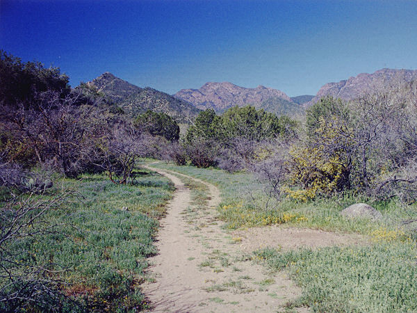
Early
in the hike, heading
towards the hills. |
|
|

