| |
Tortilla Flat Canyons - Tonto National Forest
| Summary: |
Two non-technical canyons in
the vicinity of Tortilla Flat in the
Superstition Wilderness. Some climbing ability
is required to negotiate these canyons. |
| Directions: |
From Phoenix
take US 60 east to Exit 196 for Idaho Road and
Highway 88. Drive northeast on State Highway 88
as it winds its way past the Superstition front
range and down to Canyon Lake. For Peter's
Canyon, park at the popular tourist attraction
of Tortilla Flat, for Apache Trail Canyon
continue 3.3 miles past Tortilla Flat and park
at a small pull off on the left next to a cinder
block wall that encloses an electrical transfer
box. |
| Road Conditions: |
Passenger Car |
| Navigation: |
Moderate |
| Length: |
Apache Trail Canyon - 3 miles
Peter's Canyon - 6 miles |
| Date Hiked: |
November 2006 |
| Weather Conditions: |
Sunny and warm |
|
Required Skills: |

 |
| Hike Description: |
Apache Trail Canyon:
From the parking next to the cinder block wall,
walk across the road and roughly follow the
direction of the power lines that extend
southeast from the metal tower (not the ones
that extend from the wooden pole). Look for a
route that bypasses the brush and cliffs down
into the canyon bottom. Once down, walk down
canyon and soon you'll arrive at a drop off into
a set of narrows with small pools. Bypass the
drop off by walking along a bench on the right
(when facing down canyon). Just below where
another drainage enters the canyon from the
opposite side, look for a route that will allow
you to climb down (note: the down climb is steep
with some exposure, if you are not comfortable
with the down climb, this is a good spot to turn
around). Once in the canyon bottom, if you don't
mind getting your feet wet, you can explore up
stream into the narrows. When ready, continue
down canyon. The drainage is a little brushy in
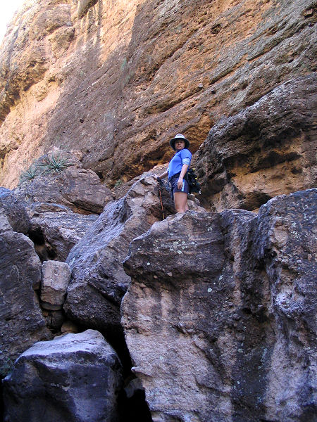
places and very rocky. You will have to do some
climbing to get past some large boulders that
have fallen into the canyon. In several spots
the boulders are exceptionally large forming
bridges and tunnels (one of which is
particularly long and dark). After some hiking,
the canyon suddenly widens out. There are two
options for escape - you could continue down
canyon until either the cliff band on the right
fades to a slope that you can climb, or follow
the canyon all the way down to where it hits
Highway 88. I opted for the former and climbed
out after walking about 15 minutes past where
the canyon became wide. The climb wasn't too
bad, but be aware that there is another minor
drainage between this canyon and the road, that
you will have to bypass or climb into and out
of. Once at the road, simply follow it back to
your car.
Peter's Canyon: From Tortilla flat, begin
your hike where Tortilla Creek crosses Highway
88. Just upstream of the road you'll soon pass a
small dam, then it's just a matter of hopping
rocks up stream. After about 15 minutes, stay
right at the 1'st confluence where Mesquite
Creek enters from the left. Stay right again
about 30 minutes later, leaving Tortilla Creek
and entering Peter's Canyon. The creek bed
becomes considerably steeper at this point and
is filled with large boulders. You'll have to do
a little route finding and climbing in order to
pick out a path up, around and between the large
rocks. Above the boulder field, the canyon
levels out and slick rock appears underfoot. The
slick rock turns back to river rock as you near
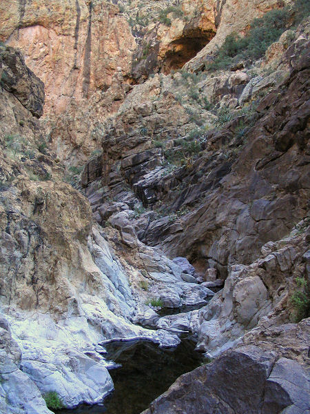
the narrow section of the canyon. The narrows
are fairly scenic with some interesting rock
formations and cave-like alcoves (the latter of
which are all unfortunately filled with trash).
There may be a few pools in the area that will
require you to climb around on one side or the
other if you are determined to keep your feet
dry. Just past a point where a huge alcove
dominates the right hand wall (facing up
canyon), the canyon widens and becomes less
interesting. Turn around whenever you feel like
it and return the way you came. |
| Rating (1-5 stars): |
    Apache
Trail Canyon Apache
Trail Canyon
  Peter's Canyon
The author and his wife completed Apache Trail
Canyon at a medium pace in 4 hours. The author
then hiked solo up through the Peter's Canyon
narrows and back at a fast pace in 3.5 hours. |
| Maps: |
Click
here for a
map.
Beartooth Maps - Superstition Wilderness Topographic Map |
|
Books: |
Canyoneering Arizona
(2nd edition)
- Tyler Williams |
| Photos: |
Click picture for larger view, click your browser's 'Back' button to return to this page. |
 |
 |
 |
|
Apache Trail Canyon. |
Peter's Canyon |
Peter's Canyon narrows. |
|
|

