| Summary: |
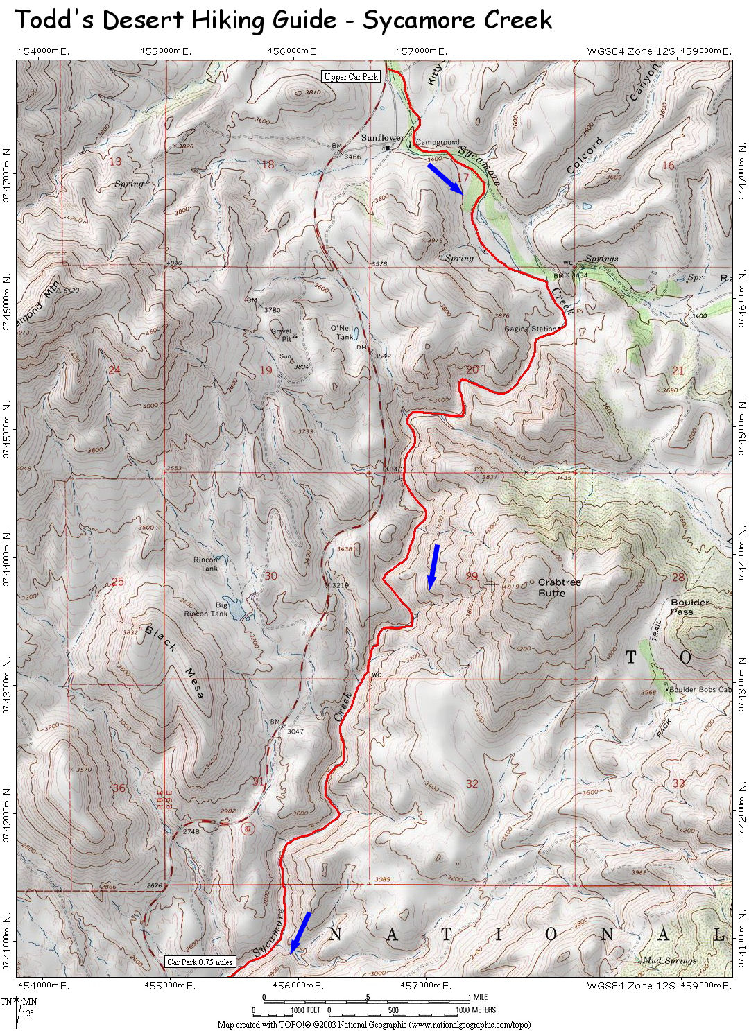
A rock hopping trip hike
along Sycamore Creek, a drainage which runs
parallel to the Bee Line Highway near Sunflower.
A car shuttle is required. |
| Directions: |
Drive
northeast out of Phoenix on the Bee Line Highway
(Highway 87).
Lower (car spot): Between mileposts 212 -
213, a short distance after crossing the large
bridge over Sycamore Creek, turn right onto a
short spur road. Drive in a short distance and
pick a spot to park near the creek (this is a
big ATV area and there are crisscrossed use
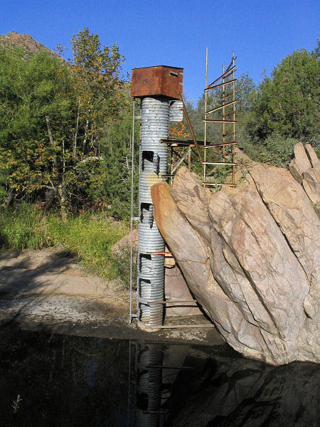
roads everywhere). The author parked near an old
steel water tank.
Upper (start of the hike): Continue
northeast on the Bee Line to Sunflower (marked
by a single building on the right side of the
road). Turn left at a signed turn directly
across from the building referenced above
(crossing the south bound lane) and take this
paved road down to a point near creek bed. I
parked beside the creek beneath a home made
billboard.
Note: It might be possible to drive closer to
the canyon by driving a little further on the
Bee Line and turning right onto a dirt road at a
sign for Bushnell Tank. However, this road was
closed due to fire danger when I was here. |
| Road Conditions: |
Passenger Car |
| Navigation: |
Moderate |
| Length: |
6 miles |
| Date Hiked: |
October 2005 |
| Weather Conditions: |
Sunny and nice |
|
Required Skills: |

 |
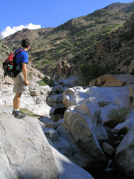
| Hike Description: |
From the upper parking area
you may have to hop over a barbed wire fence or
two to get into the stream bed. Once in, start
rocking hopping down stream. Soon you'll see a
dirt road on the left (Forest Road 22). Follow
this road until it ends in a sort of cul-de-sac
at which point you simply follow the stream.
Soon you'll pass an old gauge station and the
rock hopping begins. The upper part of the
drainage is rather brushy and you'll have to do
a little climbing around on the sides of the
creek if you want to keep your feet dry. The
water was flowing at a trickle when the author
was here and was rather sludgy, unappealing and
full of crayfish. This hike does not appear to
be a very good destination if you're looking for
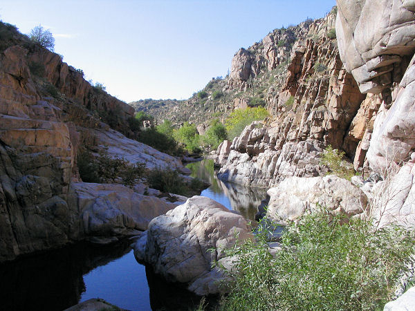
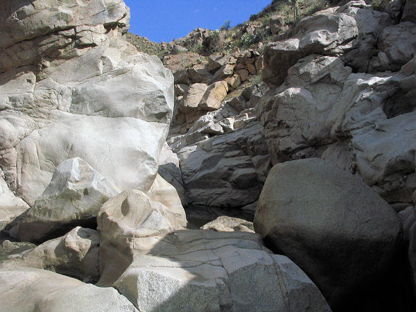
a nice swimming hole. Continue down stream and
eventually the red quartzite rock underfoot
becomes white granite and the brush fades away.
Just under half way through the canyon, the
granite forms a nice boxy section that is rather
pleasant and the saguaro dotted hills on either
side make for some good scenery. Below the box
canyon, the meandering stream straightens.
You'll know you are getting close to the end
when the canyon suddenly becomes quite wide.
There is one more short section of granite box
canyon (climb around on the left to avoid the
pools), and just below an area frequented by . .
. . um . . . . let's call them nudists . . . .
before the canyon widens out once again. After a
short hike, look for a use path up on the left
that will take you through the streamside brush
to the lower parking area. |
| Rating (1-5 stars): |


The author and a friend
completed this hike at a quick pace in 4 hours.
Water levels were low and we managed to keep our
feet dry. |
| Maps: |
Click here:
Map 1 |
|
Books: |
Canyoneering Arizona
(2nd edition)
- Tyler Williams |
| Photos: |
Click picture for larger view, click your browser's 'Back' button to return to this page. |
