| |
Little Bridge Canyon - Death
Valley National Park
| Summary: |
A hike to a little visited
canyon and two natural arches near Stovepipe
Wells Village. |
| Directions: |
From Stovepipe Village drive
east on CA 190 about 3.1 miles to where the road
completes a wide bend to the north and park next
to the side of the road. If you happen to have a
GPS, I parked at UTM 491588mE, 4050702mN. |
| Road Conditions: |
Passenger Car |
| Navigation: |
Moderate |
| Length: |
4 - 6 hours |
| Date Hiked: |
November 2004 |
| Weather Conditions: |
Sunny and warm |
|
Required Skills: |
None |
| Hike Description: |
The entrance to this canyon
is a bit tricky to find. From the road begin
hiking in a wide arc to the southeast, keeping a
long, low brown hill (which has a steel
electrical box connected to a line of telephone
poles perched on top of it) off to the east
(your left). Parallel the hill for a distance (UTM
492976mE, 4049246mN) then begin swinging right
towards a prominent 'V' shaped cleft in the
mountains above you. Do not walk right up the
drainage that crosses CA 190 like I did, since
this will lead you to a series of shallow
uninteresting drainages. Eventually, by heading
towards the cleft, you will enter the prominent
rocky drainage of Little Bridge Canyon (not
named on the map). You'll know you're in the
right place if the walls of the canyon are
colored with
dark red streaks (UTM 492820mE,
4047978mN). Slog your way up this wash and after
about 10 minutes you'll pass a white rocky
outcrop of rock that reaches to the drainage floor
on the right (facing up canyon) and 10-20
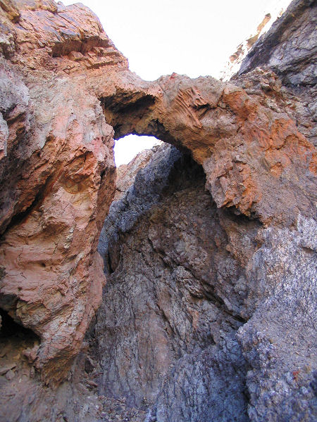
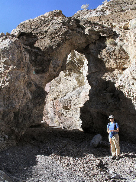
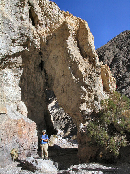
minutes later you'll reach a small, 5 foot, arch
located in the right canyon wall (UTM 492460mE,
4047080mN). Continue up canyon another 20
minutes (0.5 miles) to the little bridge which
sticks out from the right canyon wall giving the
canyon its name (UTM 492900mE, 4046610mN). I
went quite a ways further up this canyon,
exploring several side drainages as I went
(based on reports of narrows), but
found nothing further of interest worth the
effort. When ready, return the way you came. |
| Rating (1-5 stars): |
 
The author and his wife
spent a bit of time getting lost and finally
route finding a way into Little Bridge Canyon.
We then explored up to the bridge, then further
up canyon into several side drainages before
returning to our car in 5.5 hours. |
|
Maps: |
Trails Illustrated - Death
Valley National Park |
| Photos: |
Click picture for larger view, click your browser's 'Back' button to return to this page. |
|
|