| |
Golden Canyon / Gower Gulch
Loop -
Death Valley National Park
| Summary: |
A short self guided loop hike
with views of Manly Beacon, Red Cathedral and
colorful badlands, located south of
Furnace Creek. |
| Directions: |
From Furnace Creek and CA
190, drive south on Badwater Road for 2 miles to
the signed Golden Canyon trailhead on the east
side of the road. |
| Road Conditions: |
Passenger Car |
| Navigation: |
Easy |
| Length: |
4 miles |
| Date Hiked: |
November 2004 |
| Weather Conditions: |
Warm and sunny |
|
Required Skills: |
None |
| Hike Description: |
From the trailhead, parking
lot and bathroom, pick up a pamphlet which
contains details of the Golden Canyon trail
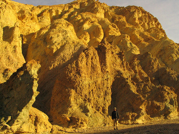
(cost = $0.25). Follow the canyon wash east into
Golden Canyon, which is composed mainly of soft,
yellow mudstone. It's easy walking as you head
up the rather wide wash which features brown
plastic numbered signs which correspond to a
couple paragraphs in the trail guide which
describe the geology and natural history of the
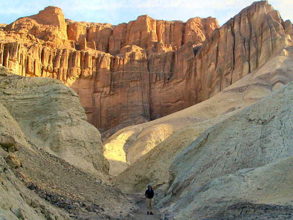
area. It's a one mile hike to the last of these
signs (#10), though you can continue up the wash for
another 1/4 miles for closer views of the Red
Cathedral, a scenic cliff face which borders
Golden Canyon to the east. After viewing the
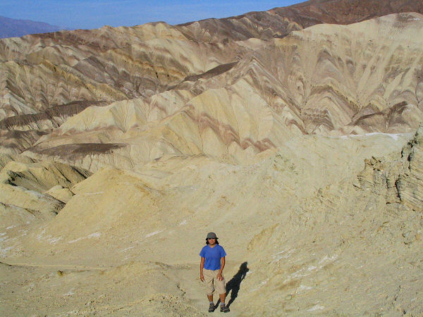
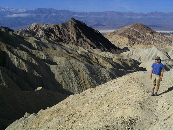
Cathedral, return to the last sign post and follow the Gower Gulch Trail south as it
climbs up through the mudstone with some nice
views of colorful badlands to the west. The path
climbs moderately steeply up and under the
prominent peak of Manly Beacon, then drops down
through a series of washes (marked at frequent
intervals by brown plastic trail signs) to a
junction with the left branching Zabriskie Point
Trail (closed due to erosion when I was here).
Stay straight at the sign and enter a wide rocky
wash. Follow the large wash down stream past a
number of old mines which were used to extract
borax and talc. Signs in the area warn of the
dangers of entering abandoned mine sites. The
wash continues west, descending a few easy drop
offs as it goes until ending in a 40 foot dry
fall with views down into Badwater Basin. The
path skirts the dry fall on the right and then
follows the foothills, somewhat faintly, heading
north back to the parking area. |
| Rating (1-5 stars): |
 
The author and his wife
completed the loop described above in 2 hours. |
|
Maps: |
Trails Illustrated - Death
Valley National Park |
| Photos: |
Click picture for larger view, click your browser's 'Back' button to return to this page. |
|
|