| |
Henry Mt. Peaks - Cedar Mesa,
Utah
| Summary: |
A short hike to the highest
peaks in the Henry Mountains (Mt. Ellen = 11,522
ft and Ellen Peak = 11,506 ft). The altitude and
cooler temperatures provide welcome relief in
the summer from the heat of the desert below.
Note: the parking area at Bull Creek pass is at
10,500 ft, you'll only have to climb the last
1000 ft of the mountain. |
| Directions: |
The route to the mountain
lies between Hanksville and the Bullfrog Marina
on Highway 95. Drive on Highway 95 and turn west
on a prominent dirt road near milepost 26.
Follow this well graded dirt road up a short
hill, then along an asphalt berm towards the
mountains in the distance. After crossing a wash
you'll reach a signed junction. Turn left at
this junction following the sign for: Eagle
Benches 6 miles, Bromide Basin 10 miles, Sawmill
Basin 15 miles, The Horn 18 miles. About a mile
later you'll reach another signed junction, turn
right following the sign for the same landmarks
as above. You'll see evidence of mining activity
in the area and plenty of spur roads. Simply
stay on the main road ignoring the others.
Another 8 miles will bring you to another
junction and sign. Perform a sharp right turn at
this junction following the arrow for Wickiup
Pass 3 miles. At Wickiup Pass turn left
following the arrow towards Bull Creek Pass 2.6
miles. After 2.6 miles look for the small pull
off on the right hand side at a few fence posts
and a brown plastic 'Trail' sign, and park.
|
| Road Conditions: |
Passenger Car
- well graded dirt roads |
| Navigation: |
Easy |
| Length: |
~6.5 miles |
| Date Hiked: |
July,
2002 |
| Weather Conditions: |
Cool and
windy with driving sprinkles |
|
Required Skills: |
None |
| Hike Description: |
From the
parking area, begin walking on the well
established trail which leads up the mountain
towards the ridge. The trail is fairly flat at
first until it reaches a low shoulder, then
begins climbing more steeply up towards the
peak. The mountain consists of lichen covered
granite rock interspersed with low alpine
vegetation. You will also see cow pies in the
area created by the buffalo that graze the
slopes. As you reach the top of the ridge line
the trail fades somewhat. You can't get lost
though, simply follow the ridge to the peak. At
the top of Mt. Ellen you'll find a mailbox with
a trail register as well as a few foxholes dug
from the rocks (which allow some respite from
the wind). You'll also see Ellen Peak to the
north separated from Mt. Ellen by a saddle. If
you wish to climb this peak as well, head down
to the saddle and climb up the other side. About
a third of the way up Ellen Peak a well defined
trail takes form, which you can follow the rest
of the way to the peak. Take in the view and
when ready, return the way you came. |
| Rating (1-5 stars): |

Very pleasant hike and a nice change from the
broiling heat of the desert. The author
completed this hike solo to Ellen Peak and back
in 3 1/2 hours. |
| Maps: |
None used |
| Books: |
Utah
Mountaineering Guide 3rd Edition -
Michael Kelsey |
| Photos: |
Click picture for larger view, click your browser's 'Back' button to return to this page. |
 |
 |
|
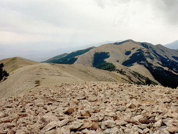
Looking across the ridgeline
towards Mt Ellen. |
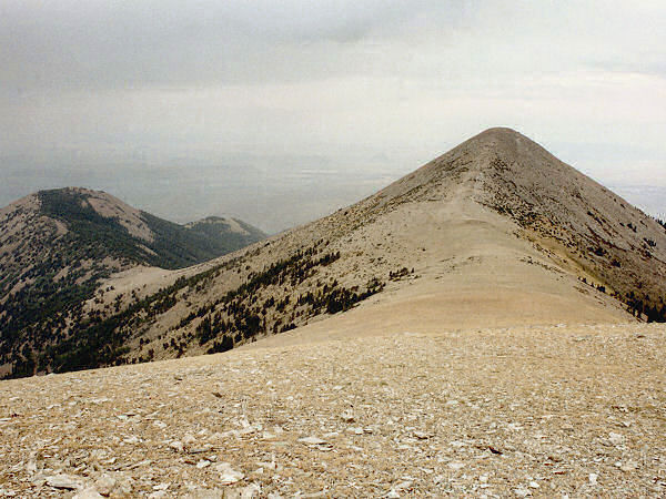
Ellen Peak from the
summit of Mt Ellen. |
|
|
|
