| Hike Description: |
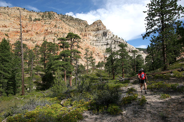
From the
Upper Death Hollow Trailhead, pick up a use
trail on the south side of the road that
descends steeply through the pine forest to soon
reach a trail register. After signing in,
continue the steep descent until the path levels
out somewhat at the Death Hollow drainage, which
is little more than a rocky, dry wash in this
area. Head downstream through the wide, forested
canyon consisting of pine, juniper and manzanita
beside or in the dry creek bed, taking advantage
of use trails along benches where they exist.
After approximately 2.5 hours of hiking, the
canyon walls recede into the distance and you'll
walk up to the left onto an extremely wide
bench. Choose a route of least resistance down
the scrubby, pine-dotted slope. After about an
hour of hiking, you'll be forced down into the
drainage once again. It's more of the same below
where you'll be walking either in the wash or on
benches until you eventually enter some low
narrows (which will feel like a brick oven in
the summer as the canyon walls radiate heat from
all sides). Where the canyon widens, look for a
rusty streak on the canyon wall on the left.
There is a spring and small pool at the base of
this streak - the first available water of the
trip. (Hike Time = 5-8 hours)
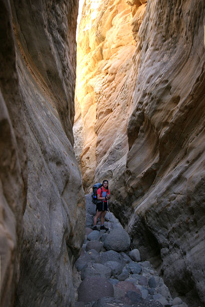
About 20 minutes below the
spring, the canyon begins to slot up once again.
You can either go through the narrows (this
section was entirely dry when I was here - but
may require wading or swimming after recent
rains) or look for a use trail marked with a
cairn that climbs up on the right and bypasses a
section before entering the drainage once again.
There is another indistinct detour below the
point where the above bypass returns to the
canyon that climbs up to the rim on the left,
but I do not recommend it since it has to detour
around several side canyons of Death Hollow and
requires some route finding and scrambling in
order to locate a route back down into the
canyon again (which becomes quite deep in this
section). It's more of the same in the narrows
below as walking alternates between hot, sandy
slogging, rock hopping and down climbing to
negotiate multiple chockstone obstacles. Just
before reaching the Right Fork of Death Hollow
you'll be faced with a 2-stage drop off that
will require webbing or rope to safely descend
(a rope may be fixed at this spot, but don't
count on it). There are pinch points at the top
of both drops to use as anchors. Just below
these obstacles, the Right Fork enters from the
left. The canyon then enters a deep section of
very nice narrows that features a few moderately
challenging downclimbs before opening up once
again at a dropoff and pool about 45 minutes
later. This is the start of perennial water in
the canyon. There is a well worn bypass around
the pool on the left that leads to a veritable
oasis in the desert.
(Hike Time = 5-8 hours).
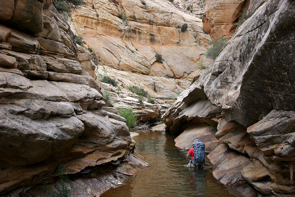
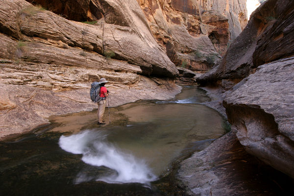
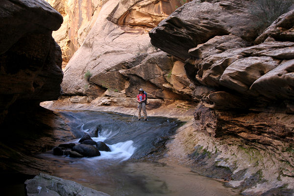
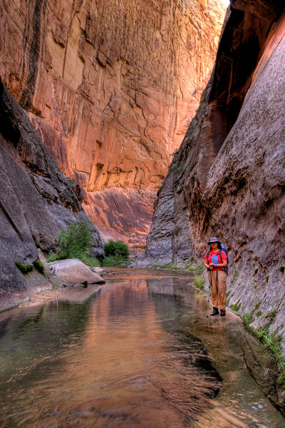
The character of the canyon
completely changes below this point with flowing
water, pools and lush vegetation. Don't bother
trying to keep your feet dry, you'll be walking
in water much of the time. In fact there are
several deep pools that will require swimming.
Unfortunately, with the appearance of water,
poison ivy also manifests itself along benches
in areas that receive shade. Keep your eyes
open, particularly if you decide to take
advantage of use trails along the benches. After
45 minutes or so of hiking, you may notice a
faint odor of sulfur in the air. This is due to
a sulfur spring that trickles from the left.
Continuing down canyon, it's more of the same as
you splash along in the water or hike on
benches. Eventually you will reach a prominent
canyon with flowing water entering from the
right.
(Hike Time = 5-8 hours).
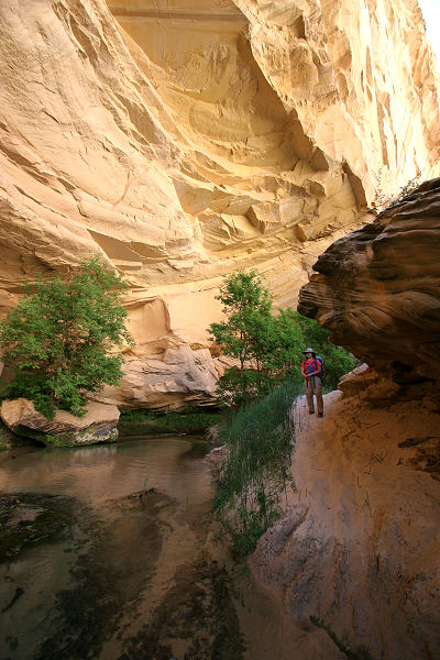
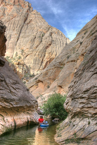
Below this side canyon, you'll
be walking directly in the streambed as the
banks of the creek become lined with thick
vegetation. It's easy walking much of the way
where the shallow stream passes over solid rock.
After some hiking you'll notice a large alcove
on the left side of the canyon and trails become
more plentiful along benches. About 15-20
minutes later you'll encounter a nice campsite
tucked into a shallow alcove on the right and
just beyond, a squirting spring at stream level
that shoots from the rock about 6 inches
straight up into the air. About 200 feet below
the spring there is a very faint track that
leads up and out of the canyon to the left. This
is the Boulder Mail Trail, which heads to the
Boulder Mail Trailhead off of Highway 12. In
case you are looking for this landmark, but
missed it, there is a large bench on canyon
right just below where the trail enters that is
covered with some very large ponderosa pines. If
you reach this point without spotting the trail,
you've gone too far. Be aware that poison ivy is
most prevalent in the vicinity of the Boulder
Mail Trail. The safest course of action in the
area is to avoid the benches and stick to the
stream bed. About 30 minutes below the squirting
spring you'll arrive at a junction for the other
half of the Boulder Mail Trail, which enters
from the right. This trail leads to the Upper
Escalante Trailhead just outside of the town of
Escalante. Continuing down canyon the drainage
eventually widens, and you'll spend more time
hiking along benches than in the water (they
become safe again the further you get from the
Boulder Mail Trail). Eventually the canyon
becomes somewhat narrower and the side canyon of
Mamie Creek enters from the right.
(Hike Time = 5-8 hours).
From Mamie Creek, continue
down canyon for about an hour to enter the last
narrows of Death Hollow. Though short, this
section is the prettiest part of the hike in my
opinion. You'll have to do some fancy footwork
in one spot to avoid going into the water up to
your neck. About 1.5 hours later, you'll pass a
huge alcove which will be on the right, and 0.5
hours later you'll reach the junction with the
Escalante River, which was a mere trickle above
Death Hollow when I was here (and evidently can
dry up above this junction during drought
conditions). Turn left and head down the
Escalante. You can either hike right in the
water or use trails to shortcut benches where
the river bends. Though the trails are more
direct, deep sand and exposure to full sunlight
may make staying in the river more attractive
during the summer months. The canyon walls
recede as you continue downstream and the
benches become larger and more attractive as a
hiking option. Eventually you will pass a large
natural arch, located high on the canyon wall on
the right, and a short distance later you'll
pass Escalante Natural Bridge, which is also on
the right. Continue down canyon until you reach
the trailhead at Highway 12 and the car you
spotted earlier.
(Hike Time = 7-10 hours). |