| |
Badger Canyon - Marble Canyon
| Summary: |
A technical down and back canyon with
some nice narrows. To successfully complete this hike you will need three
ropes (I suggest 2x50' and 1x70'), about 30ft of webbing, a harness, several carabiners, plus
descending and ascending gear. |
| Directions: |
From
Flagstaff drive north on Highway 89. Turn left on Highway 89A
towards Jacob Lake. Between mile posts 542 and 543 you'll cross a concrete
bridge above a narrow drainage - this is Badger Canyon. Park where you can
nearby. |
| Road
Conditions: |
Passenger Car - paved all the way |
| Navigation: |
Easy |
| Length: |
~5 miles |
| Date
Hiked: |
November, 2001, March 2002, updated March
2005 |
| Weather
Conditions: |
Nice |
|
Required Skills: |

 |
| Hike
Description: |
From 89A walk up canyon to the north a
short distance until the drainage becomes shallow enough to walk into. Get
into the drainage and head down canyon under the bridge. A short distance
later you will pass a small flow gauge on the left. The canyon is fairly
shallow until 15 minutes later you arrive at a confluence with a drainage
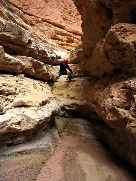
coming in on the right and a dry fall. You can get down the dry fall by
heading right along a ledge into the other drainage and climbing down a
steep, but not terribly difficult, rock wall. Fifty feet after this first
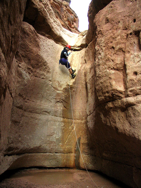
dry fall is another drop off and your first rappel (note: each time I've
done this canyon I've fixed ropes in place and used a jumar to climb out the
same way, there are other possible exit routes to the canyon, but as I have
not done them they will not be described here). There are several holes
dissolved in the rock on the right side of the canyon that you can tie
webbing through for use as an anchor or use a rock jammed under a ledge on
the left side (note: the pitons I mentioned at this drop in an earlier
description have since been removed). The rappel is about 35ft high into a
possible calf deep pool (this is the only time wading was required when I was here
and I took off my shoes to keep them dry). About 75 feet below the first
rappel point is your second drop. It consists of a chute with a ledge on
the left. You could either use the choke stones at the top of the chute on
canyon right as an anchor point (maybe a 60ft rappel and a good photo op),
but it's easier to walk the ledge on the left a short distance to a bolt
and hanger (when the author was here a rope was fixed to this anchor - I
left it in place, but used my own). A 45ft rope was plenty long to
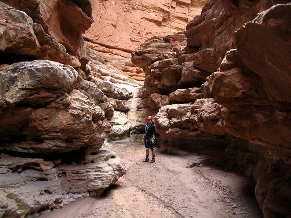
accomplish the descent from the bolt. Below this point is a nice, if
short, stretch of narrows. Further along you'll come to a 25 foot dry fall
which can be bypassed by walking along the break down on canyon right and
route finding your way down. Below this the canyon passes through another
stretch of decent narrows and passes a side canyon which comes in from the
right (see below *) before coming to another dry fall and rappel. The drop
is only about 25 feet, the anchor point used to be a small natural arch about 8
feet up on the right, but it has since disappeared. You'll now need to use
one of the large boulders on the slope on the right side of the canyon.
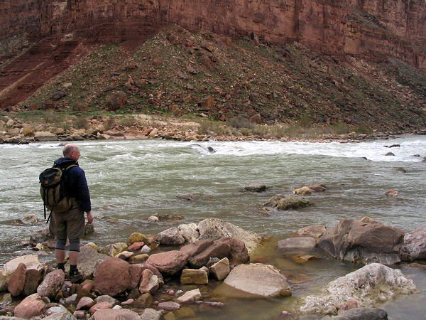
Below the third rappel you will begin to hear the faint roar of the
Colorado. It's an easy flat walk the rest of the way to the river and a
view of Jackass Canyon across from you. The
lower section of this canyon lies within Grand Canyon National Park. When
ready, return the way you came, putting your ascending gear to use and
retrieving all the rope and webbing you left on the way in.
(*) If you decide to explore this side
canyon - a couple hundred feet from it's confluence with Badger Canyon you
will come to a large dry fall. Adventurous individuals can climb up the
break down on the right (looking up canyon) and perform a sketchy climb to
a ledge which you can follow into the canyon above the fall. A short
distance later is another dry fall that the author climbed using a couple
rocks stacked on top of each other. Above this climb is a very nice, if
short, section of charming narrows before you reach a pool and another dry
fall. This one looked somewhat more difficult to climb so the author
turned around at this point (also looked like the canyon opened up above). |
| Rating
(1-5 stars): |
   
The author and his wife completed this hike (including exploration of
the side canyon) at a leisurely pace in 5 1/2 hours. |
| Maps: |
None used |
| Books: |
A few details may be found in: Canyon
Hiking Guide to the Colorado Plateau -
Michael Kelsey |
| Photos: |
Click picture for larger
view, click your browser's 'Back' button to return to this page. |
 |
 |
 |
| The first rappel. |
The second rappel. |
Badger Canyon Narrows. |
 |
 |
|
| Down climb. |
The Colorado River. |
|
|
|

