| |
Birch Hollow - Zion National
Park
| Summary: |
Normally I wouldn't reveal
the location of such a nice canyon, but I'm
afraid the cat is out of the bag and the hike
has been published elsewhere. The result is that
some non-enlightened individual has placed bolts
at every rappel point. Disappointing, but this
is still a very nice canyon and is now suitable
for the novice canyoneer. To do a loop hike, you
can go down Birch then up Orderville (a car spot
at the Orderville trailhead is useful and will
save you a 3 mile trudge). More ambitious hikers
can go all the way down Orderville, then down
the Virgin (a long day and you'll definitely
need another vehicle). Birch Hollow lies outside
the Zion NP boundary and does not require a
permit from the Backcountry Office. To complete
this hike you will need:
enough rope to perform a 110 ft rappel, harness
w/ descending gear, webbing, and helmet. |
| Directions: |
From the east entrance to
Zion NP, drive east on Highway 9 for 2.3 miles
and turn left on the North Fork Road (the first
5 miles are pave, the rest is well graded dirt).
Zero your odometer at the Highway 9/North Fork
Road intersection and drive exactly 8.2 miles to
where the road crosses a shallow wash. Park on
the left side of road next to this drainage.
Note: if you hit the abandoned houses on the
left side of the road, you've gone too far,
drive back the way you came 2 washes.
To spot a car at the Orderville trailhead, drive
another 3 miles and turn left at the sign for
Orderville to park next to the corral. Those with
a 4-WD vehicle could save even more time by
driving past the corral all the way down the
rough road to the Orderville drainage, but you
have to be pretty lazy to go through that much
inconvenience to avoid getting some exercise. |
| Road Conditions: |
Passenger Car (if roads are
dry), 4WD if you plan to drive the rough road
all the way to the Orderville drainage |
| Navigation: |
Easy (once you find the
canyon) |
| Length: |
6-8 hours, longer if heading
down Orderville |
| Date Hiked: |
September,
2003 |
| Weather Conditions: |
Warm & sunny |
|
Required Skills: |
 |
| Hike Description: |
From the parking area, route
find your way down a steep slope into the wash.
You'll have to push through some brush
initially, then the walking becomes easier. If
you're looking for clues to tell you that you're
in the right canyon, about 20 minutes into the
hike you'll pass through a short section of
gypsum narrows then cross a wood plank bridge.
After 40 minutes of hiking you'll hit a drop off
over a wide cliff band (reportedly 100ft high).
If you've brought enough rope, you could rappel
down. The easier way is to use the
developing hiker trail which bypasses this
obstacle via a steep dirt path on the left. At
the bottom of this cliff band, a 10
minute walk will bring you to another cliff
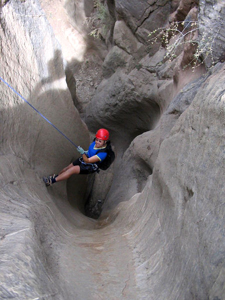
band, and your first rappel, 85 ft using the large
tree in the middle of the watercourse about 20
ft back from the edge (note 85 ft is the total
single strand rope length required). A short
stroll brings you to the narrows and the
beginning of the fun. Entering the narrows you
will have to down climb 2 drop offs of 10 ft
each (a belay for less experienced members of
your group may be desired). This is followed by:
Rap #2: 25 ft from 2 bolts and hangers (B&H) on
the left
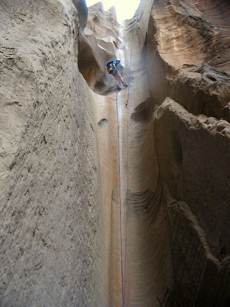
Rap #3: 110 ft down a nicely fluted wall from a
tree on canyon left walk 20 feet to
Rap #4: 35 ft from 2 B&H on the right
Note: it might be possible to combine rappels 3
& 4 with a longer rope, however if you use the
tree as your anchor you will likely have
difficulty retrieving your rope.
Rap #5: 50 ft from 2 B&H on the right
Rap #6: 40 ft from 2 B&H on the right
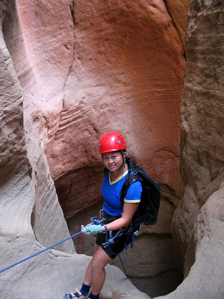
Rap #7: 80 ft from 2 B&H on the left
Rap #8: 60 ft from 2 B&H on the left
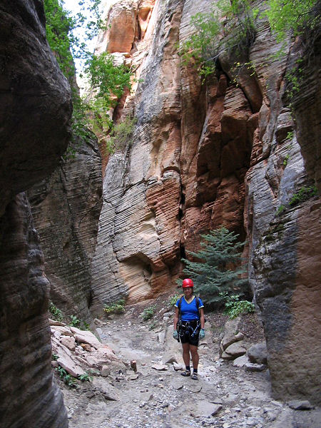
Just below this rappel the canyon begins to
widen and just beyond reaches the junction with
Orderville Canyon.
If you spotted a car at the Orderville
trailhead, turn right and walk up canyon. As you
near the head look for a prominent trail that
leads up a steep dirt slope on the right. Once
on top, follow the trail which parallels the
stream bed to the road which leads back to the
corral & your car. It will take 1 - 1.5 hours to
hike from the Orderville junction back to the
corral.
If you are heading down Orderville, turn left. A
description of Orderville may be found
here. |
| Rating (1-5 stars): |
   
The author and his wife completed this
hike with a group of 4 others in about 7 hours
at a casual pace. Along the way we found an
unfortunate (and frightened) skunk trapped in
the slot between two drop offs with no means of
escape. A member of another party hiking the
canyon notified the Park Service as to the
skunk's plight (for what it's worth, though I
suspect animal rescues are not high on the Park
Services list of priorities).
Skunk Update: After surviving
more than 2 months trapped in the canyon without
food, the skunk was rescued by 2 brave and
daring canyoneers (Mike and Rick) who took pity
on the poor creature. At great personal risk to
their olfactory senses, the skunk was wrestled
into a rope bag, carried out of the canyon and
transported to a local animal shelter. The skunk
was then fattened up over a period of several
weeks before being returned to the wild. The
very amusing account of the dramatic rescue can
be found on the canyons e-group at:
http://groups.yahoo.com/group/canyons
(search for 'skunk' in the messages section).
Great job guys! |
| Maps: |
Trails Illustrated - Zion National Park, Zion N.P. Park Map |
| Books: |
None |
| Photos: |
Click picture for larger view, click your browser's 'Back' button to return to this page. |
 |
 |
 |
|
|
Rappel #1 |
Rappel #3 |
Rappel #3 as seen
from below |
|
 |
 |
|
|
|
Rappel #7 |
Near the junction
with Orderville |
|
|
|
|

